Brevard and Volusia schools close Friday as Space Coast flooding continues
Brevard and Volusia schools closed Nov. 20 as forecasters warned of more rain. The St. Johns River near Cocoa was already in major flood stage.
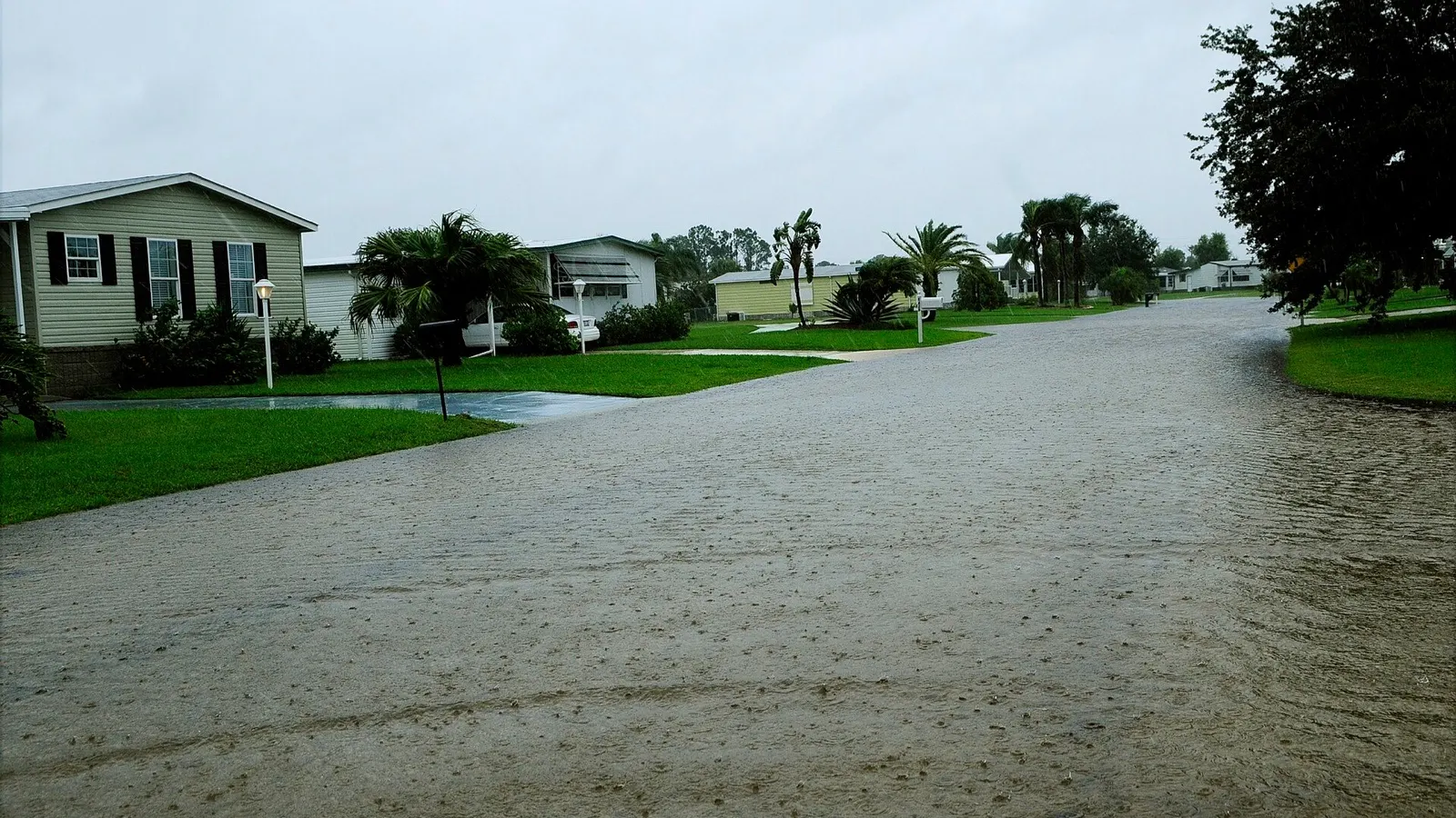
Schools in Brevard and Volusia counties are closed Friday, Nov. 20, as heavy rain and river flooding continue in east-central Florida. The Brevard district listed schools and district offices as closed. Volusia County Schools also closed its offices, canceled athletics and other school events, and said it expects students back Monday, Nov. 30, after the scheduled Thanksgiving break.
The closures follow a northward shift in the heaviest rain from South Florida toward the Space Coast. National Weather Service forecasters put portions of Brevard and Volusia in the highest category for excessive rainfall Friday. They also warned that the St. Johns River west of Cocoa was already in major flood stage. Residents can face both immediate flooding from new rain and longer-lasting flooding as the river carries water through the basin.
What’s closed, and where to check for shelter
Brevard and Volusia announced closures at the district level. Families with plans involving a private school, college or outside activity should check that organization’s own notice. In Volusia, the district specifically included extended-day programs, athletics and extracurricular activities in the closure and said canceled events would be rescheduled after the break.
Brevard’s emergency updates listed two locations for residents seeking shelter from rising water on Thursday evening, the Walter Butler Community Center in Cocoa and the Joseph N. Davis Community Center in Melbourne. Check the county’s current bulletin for availability, access and any changes before leaving. Flooded roads can affect the route even when a shelter is open.
These Friday notices cover a different part of the coast from the Broward and Miami-Dade decisions reported earlier in the week. Newsmerica’s Thursday coverage records those earlier closures. Families checking Friday schedules should follow the latest notice for their own district.
What 18.6 feet means at Cocoa
In its 3:10 a.m. Friday river statement, the National Weather Service said the St. Johns near Cocoa was at 18.6 feet at 2:15 a.m. Eastern. Flood stage at that gauge is 16 feet, putting the observed reading 2.6 feet above that threshold. The statement forecast a crest at 18.7 feet and said the river would remain within major flood stage. A crest is a forecast for the high point, and it can change with later observations and rainfall.
A river stage measures water height relative to the gauge’s reference level. It does not tell a resident the depth of water on a road or inside a home. The same bulletin offers a more direct guide to possible local impacts: at a stage of 17.2 feet, it describes water entering some low-lying homes near Lake Poinsett and parts of Rockledge and Cocoa, and possible loss of access in the Providence Road area. That is a published impact benchmark. It does not confirm the condition of any particular house.
The NOAA Cocoa gauge shows observed and forecast values on the same chart. Readers checking whether the river is actually falling should follow the observed line. The forecast line shows what forecasters expect under current conditions. The numbers apply at that gauge. They cannot be transferred to other stretches of the St. Johns without checking the corresponding gauge and warning.
Two kinds of flooding can overlap
The NWS Melbourne discussion early Friday called for a possible additional 4 to 6 inches along the Volusia and Brevard coasts through Saturday, with locally higher totals possible. Heavy rain can flood roads and other low spots faster than drainage can handle it. A flash flood warning applies to a specific area and time as that danger develops.
The river responds to rainfall accumulated upstream as well as local rain. Forecasters noted that unusually heavy rainfall in the upper basin in previous weeks had already raised water levels. That helps explain why a neighborhood can still have access problems after the rain eases or a short-term warning expires. The flood warning for the river near Cocoa was in effect until further notice in the early Friday statement.
For travel decisions, use Florida 511 for state road information and local emergency updates for neighborhood streets. Follow posted closures. The weather service warns drivers against entering floodwater or going around barricades. A forecast for improving weather can be a welcome change while flooded routes remain closed. Check the latest road and river information before assuming regular access has returned.
Trust & transparency
How we handled this story
District and Brevard emergency notices confirm closures. NWS early-Friday products document rain estimates, measured stage and forecast crest at the Cocoa gauge.

Grounded in this reporting
Ask Newsmerica
Ask about this article. Answers quote the closest published passages and link back to their sources.
This tool retrieves article passages; it does not add outside facts.Keep exploring